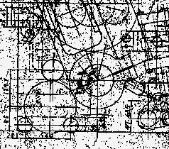
Clean and correct drawing and map scans
Coming from a scanner or a scanned archive drawings and maps often require clean-ups, alignment correction,
data reduction etc. in order to be further used in optimum quality. softelec software provides fully
automatic or controlled interactive modes for these tasks:
- eliminate irrelevant background "dirt"
- align images to correct orthogonal position vertically or horizontally
- rotate by 90° steps or cut to a standard paper format
- cut or crop images
- assign correct scaling or positioning
- smooth raster width
- eliminate irrelevant colors
- reduce or combine colors or color areas
| VPHybridCAD CAD, Engineering |
VPmap Series GIS, Mapping, FM |
||
|
|
|||
| VPindex Archiving, Indexing |