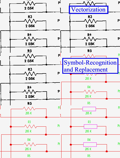
Vectorize scans automatically, trace scans
Vectorize whole raster drawings and maps to DWG, DXF, DGN or SHP using precision automatic
vectorization. Elements and widths are structured in different layers, not just to
polylines and line fragments. Powerful post-processing functions assist in quick
corrections to geometry, properties and layering.
Tracing of drawing portions or contour lines is an alternative for selective vector conversion. For area based information "polygon/polyline" tracing options provide capturing spatial data from plans and maps, even with added attributes.
 Application Video
These features are available in solutions of the following product groups:
Tracing of drawing portions or contour lines is an alternative for selective vector conversion. For area based information "polygon/polyline" tracing options provide capturing spatial data from plans and maps, even with added attributes.
These features are available in solutions of the following product groups:
| VPHybridCAD CAD, Engineering |
VPmap Series GIS, Mapping, FM |


