These features are available in solutions of the following product groups:
| VPmap Series GIS, Mapping, FM |
|
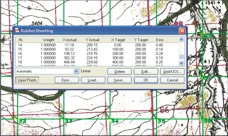
Calibrate map scans and aerial photographs accurately to correct positions, coordinates
and projections. Use program guided "rubber sheeting" functions along single reference
points or on grids for accurate calibration. Restore exact positioning and scaling. Then export images and placing
information to Geo-TIFF or in a TIF/TFW file set. These features are available in solutions of the following product groups:
|
|